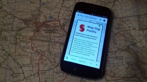
Map Digi Penfro is an online deep map created by SPAN on which you can record information that is important to you about the places you live in and pass through. Text, data, photographs, drawings, audio recordings and even short films can be placed on the map capturing perspectives, memories, conditions, stories, data, etc about that site.
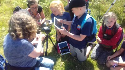
The project was developed throughout 2019 as part of Span Digidol, our 2 year digital art project starting with an intensive weekend at Garn Fawr in July 2019 followed by workshops in Narberth, Broad Haven and Newport. On each day, a group of school children and/or local residents went on a walk in their locality and recorded material on the map about local history, nature, geology, and their own memories and impressions. The result is a fascinating multi-faceted view of the place. And it was fun to do!
The map remains online and can still be added to. It is very easy to use and there are instructions on the site.
How to get involved
If you are stuck at home looking for something to do why not have a look at the map? There is much of interest to see and hear. Equally you may have your own points of interest to add. We’d love you to add to the map!

“AN EXCITING NEW DEVELOPMENT IN MAPPING AND RECORDING OUR AREA!” Fishguard local history group
Mapping days we've had
Narberth
7th December 2018, 10am-4pm
Span Arts, Narberth
Map Digi Penfro, the Pembrokeshire ‘deep mapping’ project returns for another community mapping day in Narberth on December 7th. The day is an opportunity to share stories and knowledge about Narberth with the intention of recording information to an online map in order to create a ‘deep map’ of the town and surrounding area.
https://deep-map.azurewebsites.net/
The term ‘deep map’ relates to a practice that has special relevance to Pembrokeshire. In the Spring of 2002 artist and theatre director Cliff McLucas (1945-2002) walked the whole of the Pembrokeshire Coast Path with the intention of creating a Deep Map, combining landscape picture with other media including text, diary, sound recording and moving image onto a multi-layered map.
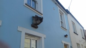
Attendees to the Narberth mapping day are encouraged to bring items such as documents, photographs and objects that might hold information about Narberth through time and space as well as their own stories about the town. In preparation for the day Span Digidol have enlisted the help of their Clwb Digi members who have been trained in digital recording, photography and how to upload materials to the map.
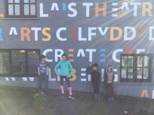
Clwb Digi digital mappers
According to McLucas’ mapping manifesto, “Deep maps will bring together the amateur and the professional, the artist and the scientist, the official and the unofficial, the national and the local.” The Span Digidol team will be joined at their base in Narberth by guide and storyteller Andrew Dugmore and other experts who will also share their knowledge in order to add to the map.
Participants from Span Digidol’s pilot mapping workshop in Garn Fawr in Summer 2019 had the following to say about the project:
“What a good idea! The whole county will be involved in individual local projects as I understand it. Presumably to contribute towards alleviating isolation in an already isolated community.”
“This is anyway a breath-taking place, but this experience has given greater insight and kept me thinking about it for long after the visit.”
“I think it is a really good idea. It will allow people to see the history of different areas on a more personal level, and find out about more about family and friends. It is also accessible to everyone.”

Map Digi Penfro are working with John Ewart from Planed’s DATRIS programme (Digital Assets and Training for Rural Innovative Solutions), Alan Cameron Wills, programmer and Span Digital Champion and Pembrokeshire College computing student Geraint Skeats. All will be on hand to assist workshop participants to upload materials collected through digital photography, audio recordings and filming onto the map.
Provisional Time-Table for the Day
10am Introduction to map
11am Guided Walk around Narberth with Storyteller Andrew Dugmore
3pm Deep Mapping in Context informal presentation by Arts Educator Iain Biggs
Broad Haven
Saturday 1st February 2019 10am-4pm
Broad Haven Youth Hostel
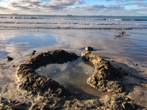
The Digidol project Map Digi Penfro continues with a hands on workshop at Broad Haven Youth Hostel. Map Digi Penfro is an online digital map that allows people to record information that is important to them about the places they live in and pass through. Information can be recorded as text or image including photographs, drawings, audio recordings and even short films.
The day will be an opportunity to share stories and knowledge about Broad Haven with the intention of recording the information collected onto the map in order to create a ‘deep map’ of Broad Haven, rich in voice and content.
Attendees to the Broad Haven Map Digi Penfro Day are encouraged to bring items such as documents, photographs and objects that might hold information about Broad Haven and the surrounding area as well as their own stories about the place.
In preparation for the day Span Digidol have also enlisted the help of Broad Haven Primary School who are investigating their school archive to find materials to put on the map. This follows on from an animation workshop Span Digidol held in the school in October 2019 inspired by the famous UFO sighting of 1977! The short film they made, ‘We are not alone’, can be viewed on the map here.
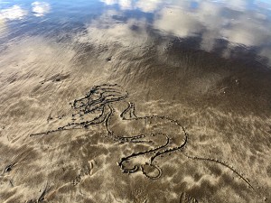
The day will be led by the Map Digi Penfro Team including the map’s developer Alan Cameron Wills and Digidol volunteer Geraint Pickard Skeats.
In Broad Haven we are also pleased to be joined by archaeologist and ‘mytho-geographer’ Erin Kavanagh who will present her own reflections on Broad Haven from the perspective of her research into the submerged landscapes of the Irish Sea including the role of the imagination in encounters with place.
Join us for Imbolc – St Bridgid’s Day – traditionally celebrated as the first day of spring on the edge of St Bride’s Bay.
No technical experience or expertise necessary.
Warm and water-proof clothing and stout footwear recommended as there will be a beach and cliff walk – weather permitting.
Timetable for the day:
10am Welcome and introduction to the project
10.15am Introduction to the Digital Map and open discussion
11am Erin Kavanagh – Approaches to Broad Haven
11.30 Recording Responses to Broad Haven
13.00 Lunch (light lunch provided – bring something to share)
14.00 Broad Haven walkabout including creative response
16.00 Session ends

All images by Erin Kavanagh
Newport and Carn Ingli
Saturday 29th February 2019, 10am-4pm
Newport Memorial Hall
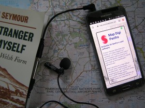
The Digidol project Map Digi Penfro heads to Newport Memorial Hall on Saturday 29th February with a day exploring a pioneering landscape with significance to issues of sustainability in agriculture and energy today.
Span Digidol will be joined by Annie Sears who will share her own story of coming to Newport and the pioneering life of her parents who farmed at Fachongle. There will also be a short film screening showing some of John Seymour’s work as a broadcaster and early advocate of sustainability.
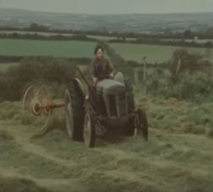
In the afternoon local guide and spoon carver Steve Jenkins will lead a short walk through Cwm Clydach and the day will conclude with a visit to Fachongle.
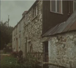
The day will also be an opportunity to share stories and knowledge about Newport with the intention of recording the information collected onto the map in order to create a ‘deep map’ of Newport, rich in voice and content.
Map Digi Penfro is an online digital map that allows people to record information that is important to them about the places they live in and pass through. Information can be recorded as text or image including photographs, drawings, audio recordings and even short films.
Attendees to the Newport Map Digi Penfro Day are encouraged to bring items such as documents, photographs and objects that might hold information about Newport and the surrounding area as well as their own stories about the place.
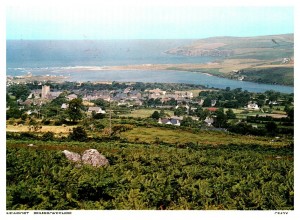
The day will be led by the Map Digi Penfro Team including the map’s developer Alan Cameron Wills and Digidol volunteer Geraint Pickard Skeats.
Timetable for the day
10am Welcome and introduction to the project
10.30am Annie Sears – The Story of a Welsh Farm with short film screening of John Seymour
12.30 Lunch (light lunch provided – bring something to share)
13:00 Walk through Cwm Clydach led by local guide and spoon carver Steve Jenkins (meet at Newport Memorial Hall)
15:00 Visit to Fachongle – John Seymour’s former home
Day ends Approx 16.00
No technical expertise needed.
Stout footwear and waterproofs/warm clothing recommended for the walk.
Map Digi Penfro has been developed through Span Arts’ Digidol project funded by LEADER and the Arts Council of Wales which is exploring new ways in which digital technology can be used creatively to increase connectivity and reduce loneliness and social isolation.
